A lake-country walk in northern Michigan can be more than a gentle shoreline stroll. Visitors seeking scenic hiking trails near Charlevoix, MI will find more than 18 options, ranging from peaceful woodland paths to longer routes. For a more demanding outing, the Jordan River Pathway stretches 19.2 miles, featuring varying terrain and steep inclines.
Guests staying at Edgewater Inn who are looking for hiking trails near Charlevoix, MI will discover options for different paces and scenery. Alongside more demanding routes, the area offers waterside walks and quieter woodland paths, making it easy to choose an outdoor adventure that suits your day.
Explore the Little Traverse Wheelway, Porter Creek Natural Area, and nearby trails to compare what each route offers. From sparkling lake views to deep forest shade, this guide can help you plan a rewarding way to experience the region on foot during your getaway.
Key Takeaways
- Match your outing to the day you want: choose from paved shared-use routes, woodland paths, and walks beside Lake Michigan.
- Consider the 26-mile Little Traverse Wheelway for a longer paved route connecting Charlevoix and Harbor Springs.
- At Porter Creek Natural Area, interpretive signs and park benches add points of interest and places to pause along the trails.
- Explore nearby options such as Mt. McSauba and North Point to experience the area’s dunes, forests, and shoreline.
1. How many hiking trails are available around Lake Charlevoix?
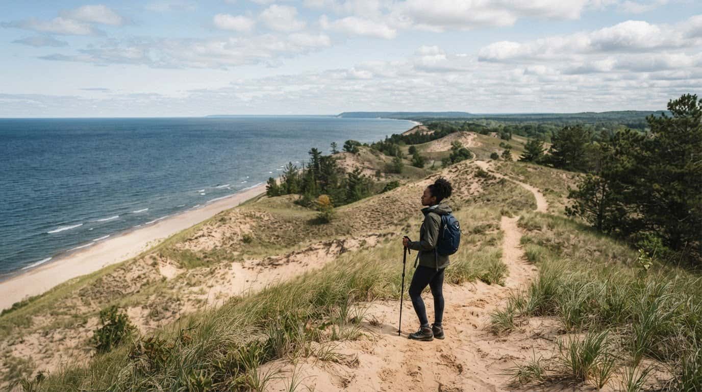
More than 18 trails serve the Charlevoix, Michigan area, with options for different walking styles. Near Lake Charlevoix, the scenery shifts between wooded paths, dunes, beaches, and open water. Mt. McSauba Recreation Area pairs dune and woodland trails with Lake Michigan shoreline. Its scenic setting offers a different feel from a quiet forest walk.
Thumb Lake Park covers more than 10 acres in Hudson Township and has more than 1,500 feet of frontage on Thumb Lake. That stretch of shoreline is its defining water-side feature. For beach amenities, plan around the lakefront itself rather than assume facilities beyond those described. The park adds a distinct waterside option to the region’s woodland and dune landscapes.
For a longer point-to-point outing, the Lake to Lake Trail is three miles long, connecting Lake Charlevoix with Lake Michigan. It’s non-motorized and can be accessed at Fisherman’s Island State Park or a trailhead on M-66. The route links two lakes, making it a useful choice for hikers seeking a walk beyond a short nature loop.
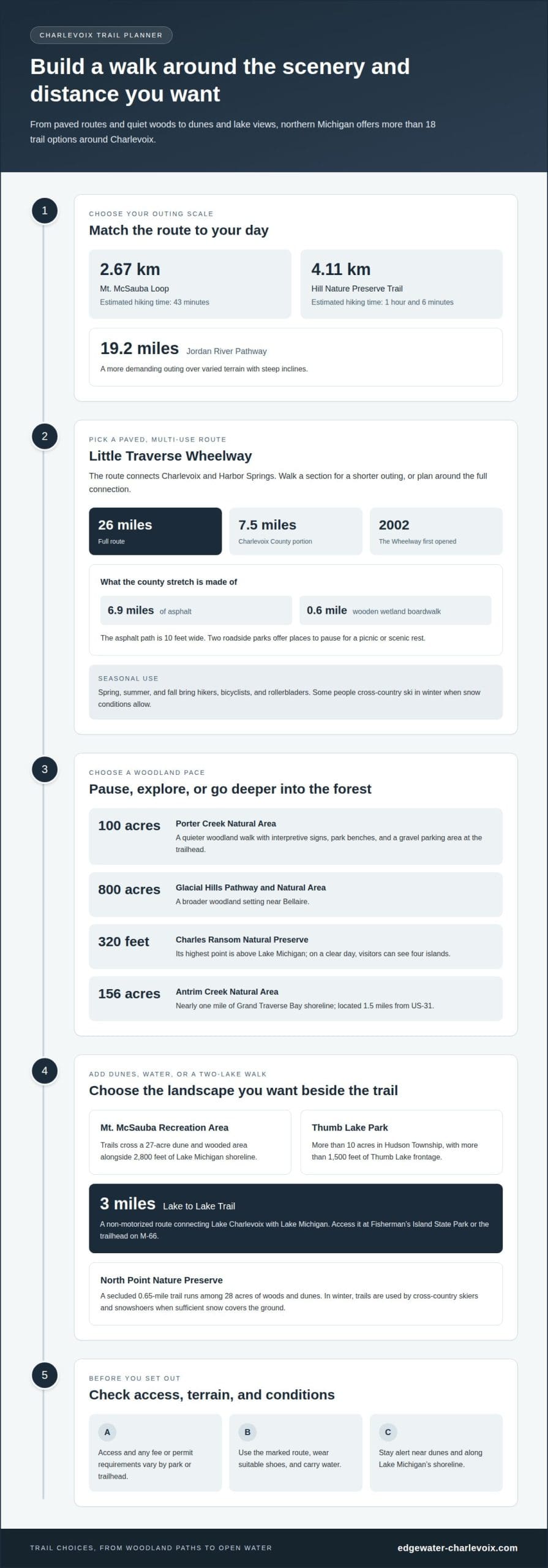
Trail lengths and estimated times vary: Mt. McSauba Loop is 2.67 km, with an estimated hiking time of 43 minutes. The Hill Nature Preserve Trail is 4.11 km and takes an estimated 1 hour and 6 minutes. For a more demanding example, the Jordan River Pathway runs 19.2 miles over varied terrain with steep inclines. Elevation figures aren’t available for every route, so choose by listed distance and terrain.
There’s no single fee or permit answer for every trail; access is tied to each park or trailhead. For parking and route access, Porter Creek Natural Area has a trailhead with a gravel parking area, while Lake to Lake Trail access includes Fisherman’s Island State Park and M-66. Before walking, use the marked route, wear suitable shoes, carry water, and stay alert near dunes and Lake Michigan’s shoreline.
2. Little Traverse Wheelway
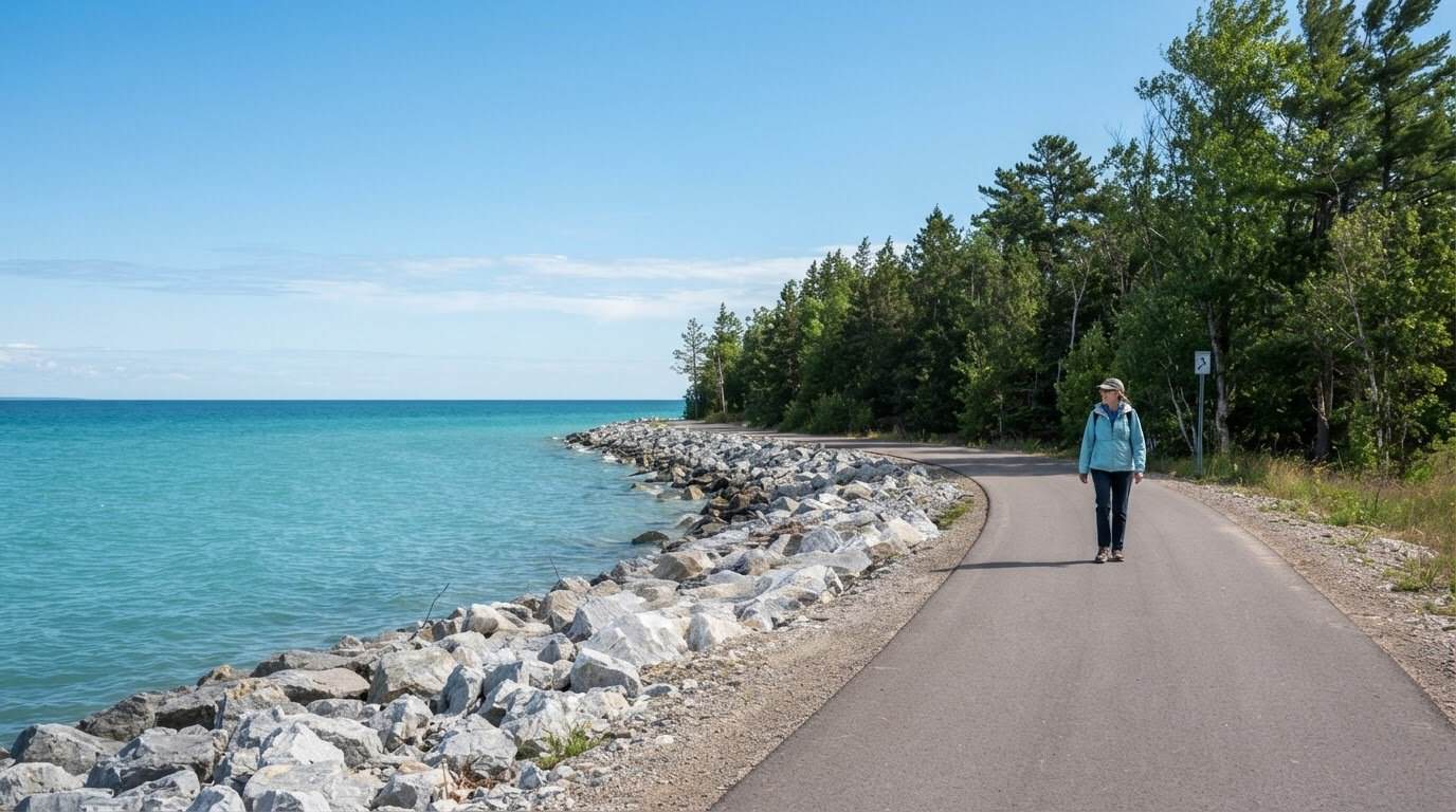
Running between Charlevoix and Harbor Springs, the Little Traverse Wheelway follows a paved route through northern Michigan. Its full length is 26 miles, making it suited to a short out-and-back or a longer journey. The Charlevoix County portion stretches 7.5 miles northeast, from Waller Road to Townline Road. The Wheelway first opened in 2002, creating a multi-use connection through the region.
Across Charlevoix County, the route includes 6.9 miles of asphalt and a 0.6-mile wooden boardwalk over wetland. The asphalt surface is 10 feet wide. That broad paved path accommodates walking and other uses, while the boardwalk offers a different perspective across a wooded wetland. Two roadside parks provide places to pause for a picnic or scenic rest.
Spring, summer, and fall bring hikers, bicyclists, and rollerbladers to the Little Traverse Wheelway. In winter, some people cross-country ski along it, though this is a less common seasonal use. Snow conditions determine whether winter travel is practical. The Wheelway is a multi-use trail, but activities vary by season.
For current conditions, a report dated July 21, 2026 described a closure about two miles north of Charlevoix. The reported detour required users to travel on Route 31’s shoulder for about three-quarters of a mile. That dated report describes a specific disruption, not a year-round closure schedule. Seasonal use also shifts: summer brings cycling and walking, while winter use depends on snow.
For a manageable outing, choose a Wheelway access point, then walk a section and return along the same route. The paved surface and roadside parks make it easy to break the distance into smaller walks. For a longer traverse, plan around the full 26-mile connection between Charlevoix and Harbor Springs, allowing time for the route’s scale and changing scenery.
3. Porter Creek Natural Area trails and landscape
Porter Creek Natural Area covers 100 acres in Wilson Township, offering a quieter woodland walk. Charlevoix County acquired the property from the Michigan Department of Natural Resources in 1997. Its hiking trails include interpretive signs, park benches, and a gravel parking area at the trailhead. These features make it easy to pause, read about the landscape, and enjoy the natural area at an unhurried pace.
For a broader forest setting, Glacial Hills Pathway and Natural Area near Bellaire covers 800 acres. Its extensive woodland offers a different scale from Porter Creek’s 100 acres. These contrasting sites help hikers choose between a smaller nature preserve visit and a more expansive forest outing. In winter, North Point Nature Preserve’s trails are used by cross-country skiers and snowshoers when sufficient snow covers the ground.
Charles Ransom Natural Preserve adds elevation and open views to the region’s trail mix. Its highest point reaches 320 feet above Lake Michigan, and visitors can see four islands on a clear day. That combination makes the preserve a distinctive stop for hikers seeking a higher vantage point. The lake and island views provide a striking contrast with the shaded woodland scenery at Porter Creek.
South of the Charlevoix-Antrim County line, Antrim Creek Natural Area protects 156 acres and nearly one mile of Grand Traverse Bay shoreline. It lies 1.5 miles from US-31, combining a shoreline setting with a natural-area walk. Together, Porter Creek, Glacial Hills, Charles Ransom, and Antrim Creek offer varied choices: interpretive woodland trails, expansive forest, elevated lake views, and a bay-side landscape. Pick a preserve by scenery and preferred walking setting, then allow time to pause at its distinctive features.
4. Trails near Charlevoix
For varied scenery close to town, combine Charlevoix’s dune paths with wooded nature preserves and longer routes nearby. Mt. McSauba Recreation Area has trails across a 27-acre dune and wooded area, alongside 2,800 feet of Lake Michigan shoreline. North Point Nature Preserve adds a quieter woodland option, with a secluded 0.65-mile trail among its 28 acres of woods and dunes. Together, the neighboring landscapes offer contrasting walks without requiring a long trek.
How far are popular hiking trails from downtown Charlevoix? Mt. McSauba and North Point are in Charlevoix; Susan Creek Nature Preserve is four miles east of the city limits. Its entrance is 0.6 miles south of Big Rock Road, giving hikers a clear landmark for planning a visit. The distance from downtown varies with the chosen trailhead and route, so consider the specific destination when planning travel.
At Susan Creek, 2.37 miles of trails cross a 314-acre preserve. A winter-only ski loop adds a mile, creating a seasonal option beyond hiking. Whiting Park offers a park setting near Lake Charlevoix. Its Ridge Road loop is 3.47 km, with an estimated hiking time of 59 minutes. These routes offer different ways to pace a day, from a short loop to several connected paths.
For a more demanding outing, the Jordan River Pathway runs 19.2 miles and features varied terrain with steep inclines. That longer route offers a stronger challenge than a brief woodland loop. Choose based on distance and terrain, then allow time for a relaxed stop or picnic during the outing. With dunes, forest, shoreline, and longer pathways all represented, Charlevoix’s nearby trails suit both unhurried walks and ambitious days outdoors.
Edgewater Inn
After exploring Charlevoix’s shoreline, woodland, and longer routes, Edgewater Inn offers a comfortable place to return between outdoor days. One Bedroom Suites and Two Bedroom Suites provide options for a stay in Charlevoix, while Wedding Venue Packages serve a different occasion. Each suite has a fully equipped kitchen and a private balcony with water views, bringing a quiet waterfront setting into the rhythm of your visit.
Whether you’re planning several trail outings or pairing a walk with time by the harbor, choose a stay that suits your trip. Explore Edgewater Inn’s suites as you plan, then contact the inn to discuss your stay.
Make Your Charlevoix Stay Part of the Adventure
Planning outings on hiking trails near Charlevoix, MI, also lets you shape your stay around the pace you enjoy. Leave room for an unhurried morning, a waterside pause after a walk, or another day to explore a different landscape. A comfortable home base can make these moments part of the journey.
Edgewater Inn offers One Bedroom Suites and Two Bedroom Suites for stays in Charlevoix, as well as Wedding Venue Packages for celebrations. Whether you’re planning a walking getaway or bringing loved ones together, choose the option that fits your trip.
Contact Edgewater Inn about your stay and begin shaping a Charlevoix visit that feels like your own. May the next trail lead you to a view worth lingering over.
Frequently Asked Questions
Are there any longer or more challenging hikes for experienced adventurers?
Yes. The Jordan River Pathway offers a long outing across varied terrain with steep inclines. For a shorter but substantial loop, Avalanche Mountain near Boyne City is 7.09 km, with an estimated hiking time of 1 hour and 58 minutes. Choose by both distance and terrain: steep climbs can make a route demanding even when its overall length is manageable.
How many hiking trails are available around Lake Charlevoix?
More than 18 trails are available in the Charlevoix area. Rather than trying to cover several in one day, choose a starting point and scenery that suit your plans. A lakeside walk, wooded preserve, and longer pathway offer different experiences. For a calmer outing, plan one main route and leave time to pause at the trail’s natural features.
What else can I explore near the hiking trails?
Pair a walk with time in downtown Charlevoix, where dining and shopping offer an easy change of pace. Nearby beaches are ideal for a relaxed stretch beside the water, and local galleries provide an indoor stop. Plan the day around a hike, then leave time to explore downtown or linger near the shore.
What natural features or viewpoints can I discover on hikes around Lake Charlevoix?
Expect a mix of woodland, dunes, lakeshore, and creek landscapes. Susan Creek Nature Preserve has nearly a mile of frontage along Susan Creek. North Point Nature Preserve protects Pitcher’s Thistle, Lake Huron Tansy, and Pumpell’s Bromegrass, three threatened plant species. On a clear day, Charles Ransom Natural Preserve offers views of four islands across Lake Michigan.
Where can I find easy hiking trails suitable for beginners?
Mt. McSauba Loop is a shorter option, measuring 2.67 km, with an estimated hiking time of 43 minutes. New hikers can keep the outing comfortable by walking at an easy pace and turning back if they’re on an out-and-back route. For a more level-feeling walk, the paved Little Traverse Wheelway lets you choose a shorter section rather than tackle its full length.
What are the best hiking trails near Charlevoix, Michigan?
The best route depends on the experience you want. Porter Creek suits a quieter nature walk, while Mt. McSauba combines dunes, woods, and shoreline. The Little Traverse Wheelway is a paved option with flexible distance, and the Jordan River Pathway offers more demanding terrain. Choose based on the scenery you prefer, your available time, and how much elevation change you want.